Geo-zones
A geo-zone is an area that you draw on the map, for example your depot, a customer’s warehouse or a road with a speed limit. Use geo-zones to get alerts when vehicles arrive or leave, and in reports.
Click Geo-zones in the top menu to open them.
The geo-zone page
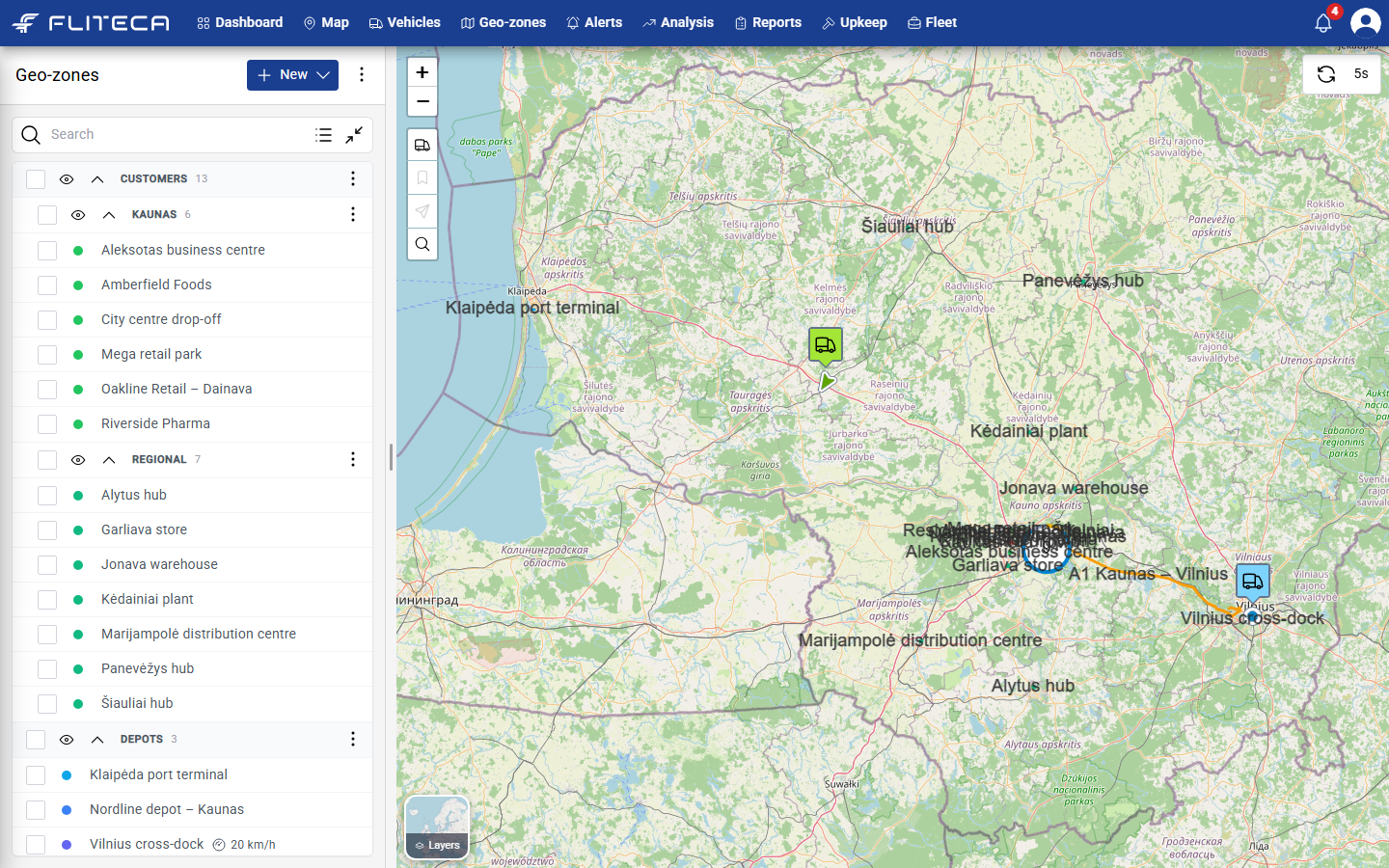
On the left is the list of your geo-zones, sorted into groups.
On the right is the map with all geo-zones drawn on it.
Type in Search to find a geo-zone by name.
Click the eye next to a group or geo-zone to hide it from the map or show it again.
Draw a geo-zone
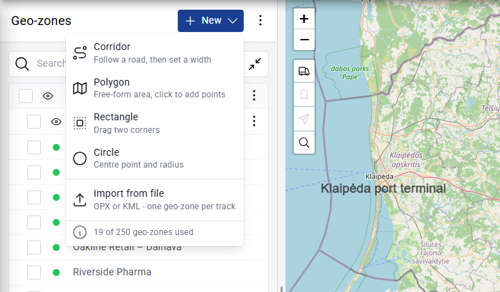
Click New and choose a shape:
Corridor – follows a road. Click points along the road and finish on the last point. Then set the width.
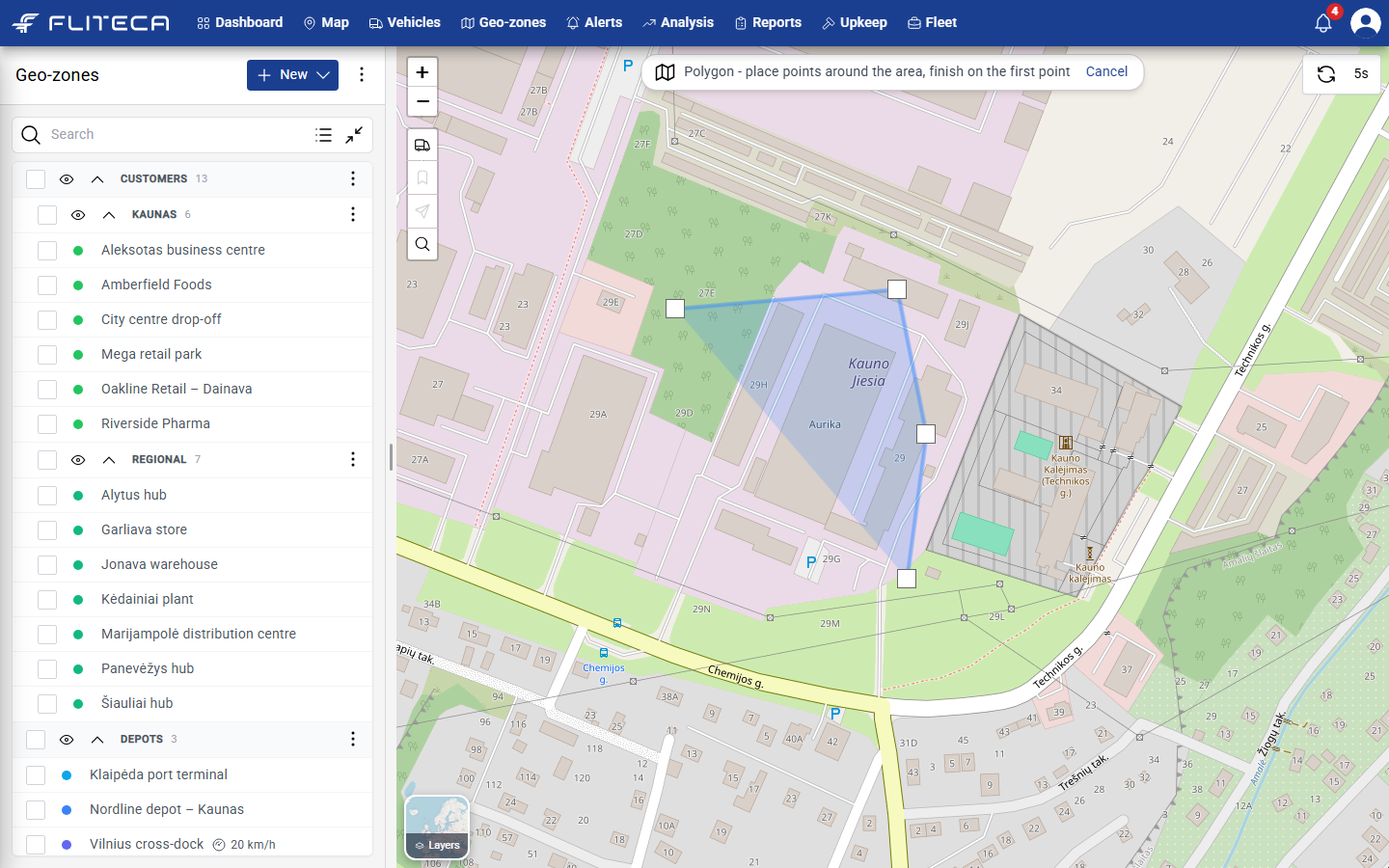
Polygon – any shape. Click points around the area and finish on the first point.
Rectangle – drag from one corner to the opposite corner.
Circle – click the centre and drag out the radius.
Import from file – load a GPX or KML file. Each track in the file becomes one geo-zone. See Import geo-zones.
The bottom of the menu shows how many geo-zones your plan allows.
Draw the shape on the map. A hint at the top of the map tells you what to do. Click Cancel to stop.
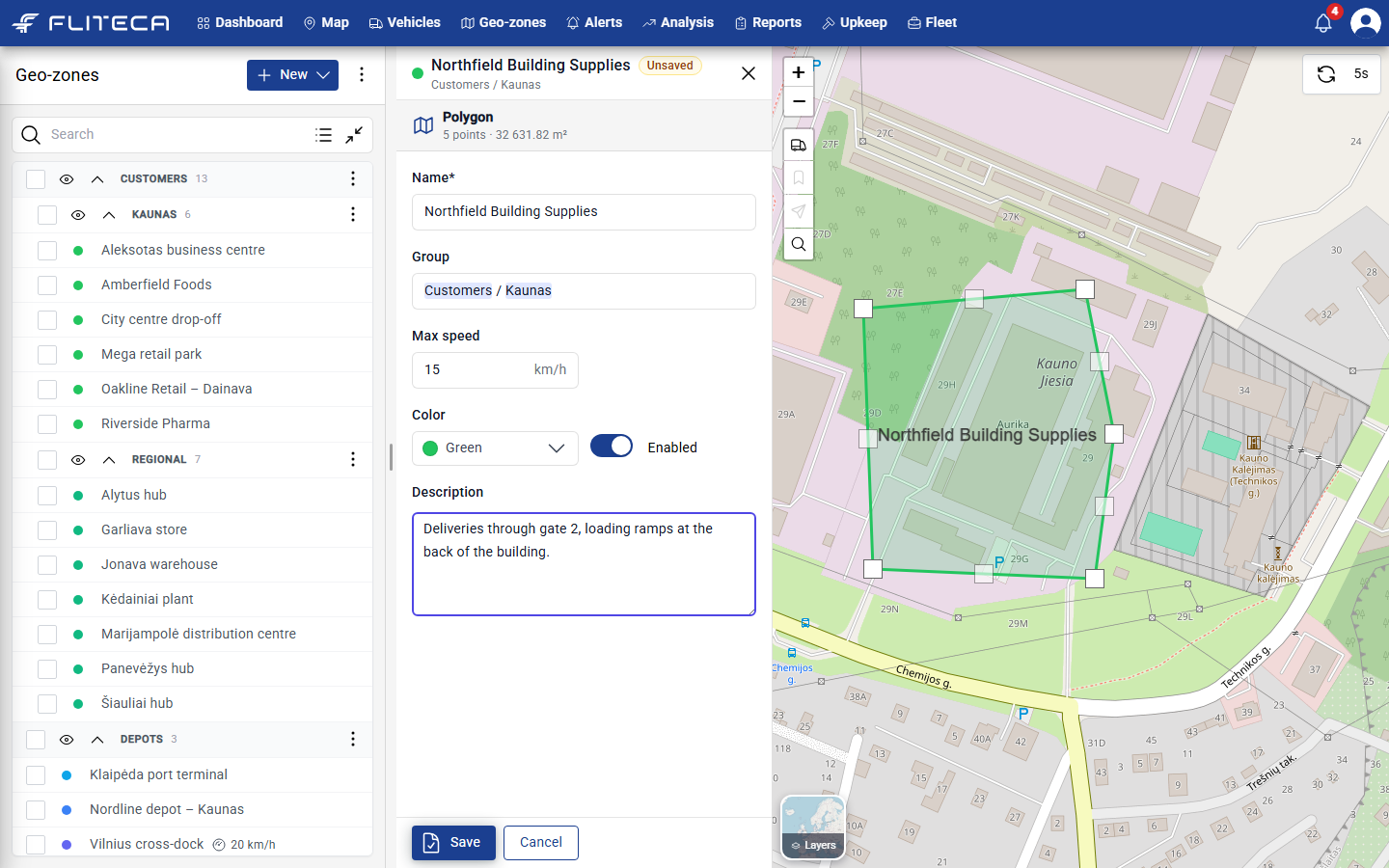
Fill in the form that opens:
Name – for example the customer’s name.
Group – type a group name. Use / to put a group inside another one, for example
Customers / Kaunas.Max speed – optional speed limit inside the zone. The Geo-zone overspeeding report uses it.
Color – the color on the map.
Enabled – switch it off to stop alerts for this zone without deleting it.
Description – notes for your team, such as which gate to use.
Click Save.
Tip
To change the shape later, drag the white squares on the corners. Drag a small square between two corners to add a new corner.
Corridors along a road
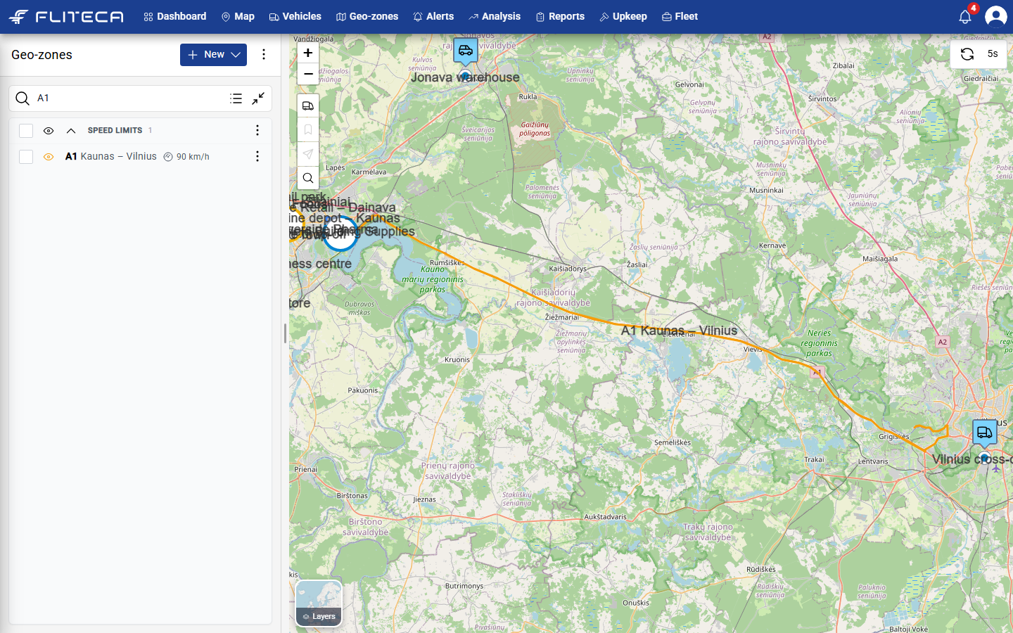
A corridor is a band along a road. Use it for speed limits on a highway or for a fixed delivery route.
Import geo-zones from a file
If you already have your customers or routes in a GPX or KML file, you can import them all at once. See Import geo-zones.
Edit, copy or delete a geo-zone
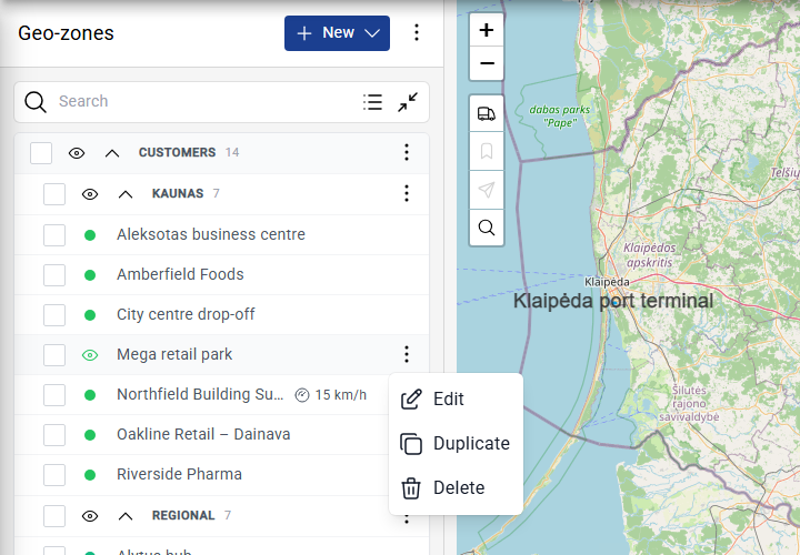
Click the three dots next to a geo-zone and choose Edit, Duplicate or Delete. You can also click the geo-zone on the map to edit it.
Change many geo-zones at once
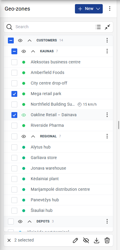
Tick the boxes next to the geo-zones. Tick a group to select everything in it.
Use the buttons at the bottom of the list to edit, hide, download or delete the selected geo-zones.